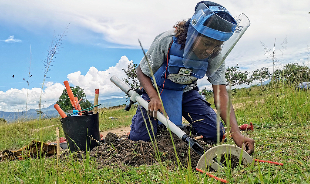
UAV LiDAR improves land mine clearance planning
Posted on August 2, 2023 in Survey & mapping and UAV LiDAR
We are extremely proud of this new case study which discusses the collaboration between Routescene and The HALO Trust to determine the effectiveness of UAV LiDAR to improve land mine... Read more
Improve powerline vegetation management using UAV LiDAR
Posted on October 4, 2021 in Forestry, Research, Survey & mapping, UAV LiDAR, and Utilities
This is the sixth in our series of forestry related case studies to demonstrate the superior capabilities of the Routescene UAV LiDAR system for forestry management use. This LiDAR powerline... Read more
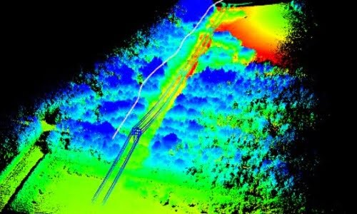
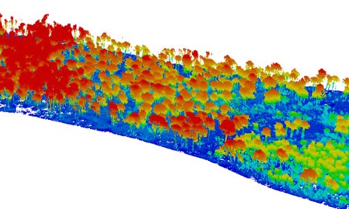
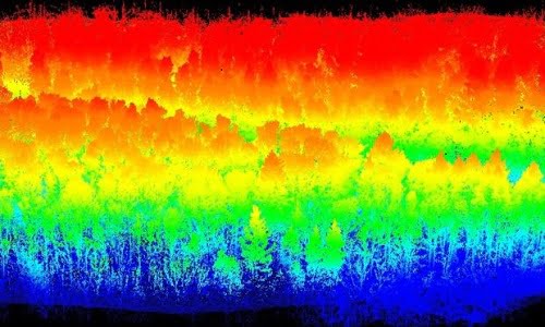
How UAV LiDAR technology is transforming operational forest management
Posted on August 17, 2021 in Environmental, Forestry, Research, and UAV LiDAR
Applications of UAV LiDAR forest management Point cloud data captured using UAV LiDAR continues to demonstrate its value in this forestry case study. The Digital Terrain Model (DTM) created illustrates... Read more
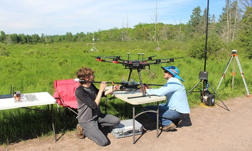
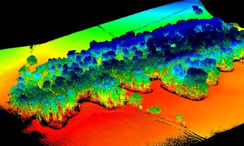
LiDAR forestry surveys to inform carbon reduction policies
Posted on July 14, 2021 in Forestry, Research, and UAV LiDAR
Forest canopy structure characterization using Routescene drone LiDAR system This forestry project, undertaken by the University of Wisconsin-Madison (UW-Madison), employed a Routescene LiDAR System RS4 on an Unmanned Aerial System... Read more
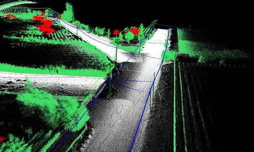
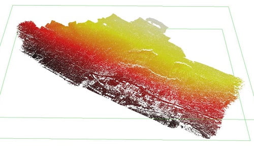
LiDAR mobile mapping system used to plan upgrade of powerlines
Posted on June 14, 2021 in Survey & mapping, UAV LiDAR, Utilities, and Vehicle LiDAR
Powerline mapping to improve supply efficiencies Electricity distribution company Fortis wished to upgrade out-of-date copper distribution lines in a neighborhood within the small, rural town of Oliver, British Columbia, Canada.... Read more
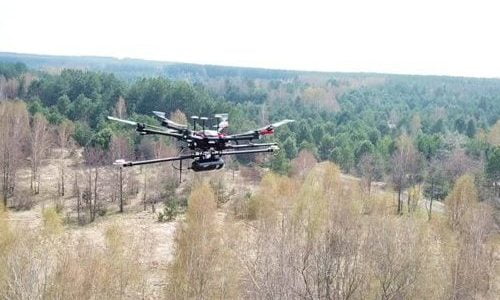
Using UAV LiDAR to assess vegetation and establish forest fires severity
Posted on May 21, 2021 in Environmental, Forestry, Research, and UAV LiDAR
Using UAV LiDAR to understand the characteristics of forest fires Forest fires are becoming more common due to climate change and bring considerable ecological and economic loss. Understanding the characteristics... Read more
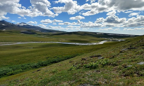
UAV mapping the Arctic tundra to understand climate change impacts
Posted on November 25, 2020 in Environmental, Forestry, Research, and UAV LiDAR
As the permafrost warms in the Arctic, the landscape is undergoing rapid change, evidenced by vegetation shifts and the release of carbon dioxide and methane into the atmosphere, gases... Read more
UK drone LiDAR mapping provider discuss experiences using their Routescene system
Posted on July 1, 2020 in Environmental, Survey & mapping, and UAV LiDAR
In March 2020 we interviewed Michael May and Ben Bishop, Directors of FlyThru, a drone LiDAR mapping provider based in the UK. Flythru invested in a Routescene UAV LiDAR... Read more
Vehicle and drone based LiDAR forest mapping protects Scottish woodland
Posted on July 1, 2020 in Environmental, Forestry, Survey & mapping, UAV LiDAR, and Vehicle LiDAR
The Routescene team assisted Innovair, a Scottish based survey and inspection service company, to carry out LiDAR forest mapping of an area managed by Forestry and Land Scotland. This... Read more
Using UAV LiDAR mapping to monitor landslides safely
Posted on April 28, 2020 in Environmental, Survey & mapping, and UAV LiDAR
LiDAR mapping landslides in Ystalyfera, South Wales, UK UAV (Unmanned Aerial Vehicle) LiDAR offers unparalleled capability where accurate mapping is essential but difficult to achieve. Examples include hard to reach,... Read more
UAV LiDAR mapping helps reveal radiation hotspots at Chernobyl
Posted on April 26, 2020 in Environmental, Forestry, Research, and UAV LiDAR
Routescene UAV LiDAR mapping technology used to map Chernobyl forest After thirty years since the explosion at Chernobyl, a team of researchers have used the Routescene UAV LiDAR mapping system... Read more
Drone land surveying to locate, identify and preserve old trees
Posted on April 25, 2020 in Environmental, Survey & mapping, and UAV LiDAR
A UAV LiDAR mapping system has many different applications – this one was specifically to protect the next generation of ancient trees. Using the Routescene UAV LiDAR System the FlyThru... Read more
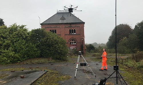
Drone LiDAR surveying locates new structures at WWII prison camp
Posted on November 15, 2019 in Archaeology, Research, and UAV LiDAR
Archaeological UAV LiDAR surveying reveals hidden structural elements The Routescene UAV LiDAR System and data processing software were key components in an archeological survey on Alderney in the Channel Islands,... Read more
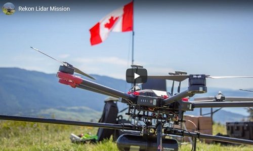
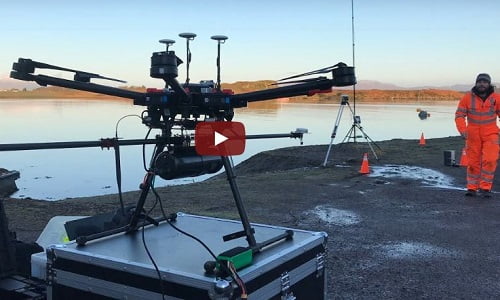
Transmission line survey using LiDAR for drones system
Posted on September 16, 2019 in UAV LiDAR and Utilities
LiDAR for drones use case by Rekon Solutions Watch the video as Routescene customer Rekon Solutions Inc set up and fly their UAV LiDAR System on their drone. The survey... Read more
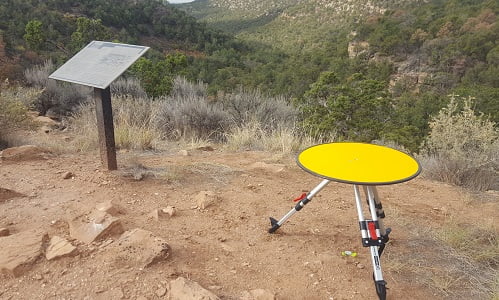
UAV LiDAR used in archaeology to identify 750 year old structures
Posted on August 6, 2019 in Archaeology, Forestry, and UAV LiDAR
Mapping the Canyons of the Ancients National Monument When Crow Canyon Archaeology Center and the Canyons of the Ancients National Monument looked to map Sand Canyon, an ancestral Pueblo site... Read more
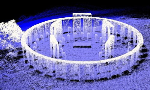
LiDAR aerial mapping of “Stonehenge replica” military monument, USA
Posted on July 26, 2019 in Archaeology and UAV LiDAR
WWI monument captured using drone LiDAR The Glasgow School of Art has published a book to celebrate some of the most beautiful and striking LiDAR point cloud datasets from around... Read more