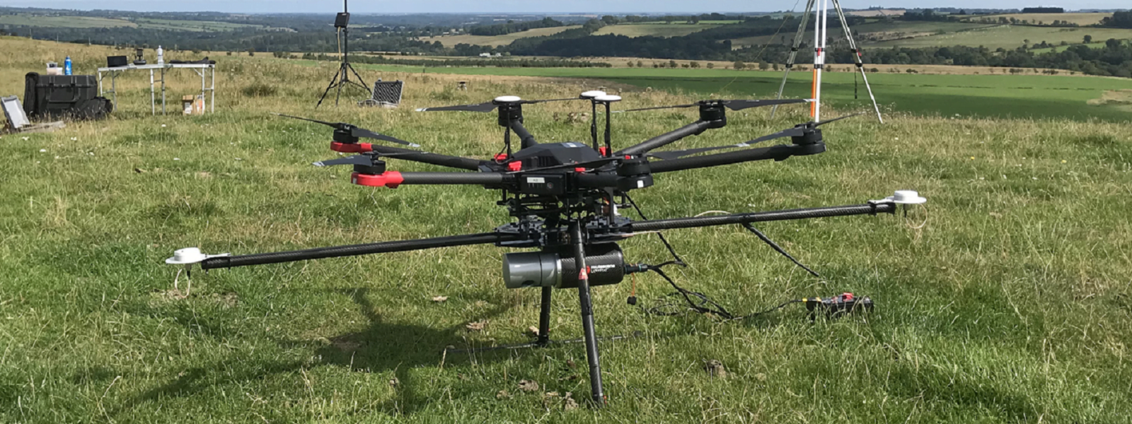
UAV LiDAR Systems
Range of LiDAR mapping hardware and software solutions for drones.

Easy to deploy improved design
New substantial improvements to Routescene's drone LiDAR Systems enable easy deployment in the field. Hinged, foldaway GNSS antenna and antenna poles, a new drone mounting system design incorporating quick-release connectors and rapid data download via USB3 mean no tools are needed for set up.Animation courtesy of Vivid Nine.
Why choose a Routescene UAV LiDAR System?
Choosing the right LiDAR mapping solution can be difficult. Routescene offers a full hardware and software suite plus a range of options to meet different applications, performance and price requirements. Our team of experts can help you choose the right solution for your application.
System options to meet diverse specifications and budgets.
Our software makes data processing easier and quicker.
Comprehensive training and support to get the most out of your system.
Workflow to bring efficiencies and improve productivity.
What is included?
Every Routescene drone LiDAR system includes everything you need to capture and process LiDAR data.
Data processing software
Comprehensive tools and workflow to generate results easily and proficiently.
System options
We have 3 options to suit your performance and price requirements. To help you choose the best system for your needs, the table below outlines the suitable applications and key features for each option.
RS1
Lowest cost; High accuracy; Good all purpose system
Applications
Spec
Recommended flying altitude
197 feet / 60m
LiDAR range accuracy
Exceptional
Accuracy of the overall system
Good
Default INS sensor
Mapping grade
Dual heading
Included
RTK receiver in Ground Station
Optional
Resolution
Good
Weight
4.9lbs / 2.2kg
Price
$
RS2
High altitude; Survey grade; LiDAR sensor made USA
Applications
Spec
Recommended flying altitude
394 feet / 120m
LiDAR range accuracy
Fair
Accuracy of the overall system
Good
Default INS sensor
Survey grade
Dual heading
Included
RTK receiver in Ground Station
Optional
Resolution
Good
Weight
5.1lbs / 2.3kg
Price
$$
RS3
High altitude; Highest accuracy; Lightest weight
Applications
Spec
Recommended flying altitude
394 feet / 120m
LIDAR range accuracy
Exceptional
Accuracy of overall system
Exceptional
Default INS sensor
Survey grade
Dual heading
Included
RTK receiver in Ground Station
Optional
Resolution
Exceptional
Weight
4.2lbs / 1.9kg
Price
$$+
What drone LiDAR mapping system do I need?
Determine your application
UAV LiDAR is particularly suitable for surveying sites covered by woodland, shrubs and plants, especially when you need to penetrate through the vegetation to achieve a Digital Terrain Model (DTM); or to overcome difficult terrain or hazardous locations such as landslides.
Your application will inform the data accuracy, data resolution and flying height you need. These factors help you decide which hardware option you require.
Establish what your deliverables are
Examples of deliverables to your end client are digital products such as a Digital Terrain Model (DTM) or Digital Surface Model (DSM); contour maps; a list of features or assets to inform management plans; and forest mensuration reports to inform carbon credit or harvesting. As part of these deliverables you will need to confirm the data density, positional accuracy and coordinate system of the dataset.
Establishing your deliverables will help you decide what tools you require in the post processing software to analyze and process the data.
What is the maximum height of objects that you need to survey?
This factor determines the LiDAR scanner that is most suitable: the maximum range of a scanner indicates how far away it can detect objects. Surveying very tall trees for example means you have to fly much higher to avoid the tallest tree and thus you will need a scanner with a longer range.
What is the absolute accuracy that you need to achieve?
Once you have established this factor you should review the range accuracy of the LiDAR scanner in each UAV LiDAR system option to establish which ones will give you the accuracy you need. In addition, you need to review the angular accuracy of the two GNSS/INS sensor that are available as options. The GNSS/INS sensor has an angular error, so the further away your object is from the sensor the less accurate the overall accuracy will be. To fully understand what accuracy means, have a read of the following article: UAV LiDAR accuracy.
Do the areas you intend to survey have high vegetation?
Again this factor determines the LiDAR scanner options that are suitable for your UAV LiDAR system. For each scanner option review the number of lasers, the Field of View, the number of points / second and the number of returns. All these attributes, plus flying altitude and speed, impact the number of hits you will get from the ground.
Do you have a UAV that you will be using for LiDAR?
If yes, what is the endurance, flying speed and payload capability? The endurance of the UAV will dictate the size of the area you can fly in one mission and it directly impacts the efficiency of the project. Read this article to find out more.
Is the data you will collect classified or sensitive?
Are you a Government Agency, or are you surveying critical infrastructure, and need to ensure your data is not processed by a third party in the cloud? This will inform the software platform (Desktop or web) that you should use to post process your data.
