
LiDAR mobile mapping system
Vehicle LiDAR system and software for road based surveys.

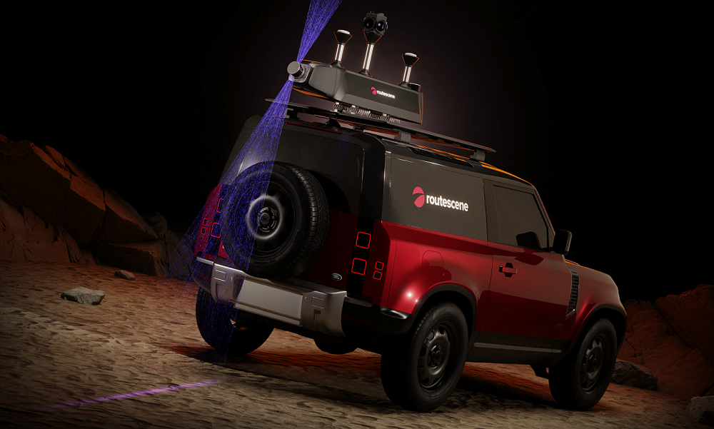
Complete hardware and software package
At Routescene we are renowned for our high calibre system design, manufacture and service delivery. We have applied 30+ years’ experience across surveying, LiDAR, GNSS / INS, software development, dynamic data capture and data management to develop this technology. You’ll also have access to our world-class customer support and training to help you get the most out of your system.
Why choose a Routescene LiDAR mobile mapping system?
Complete package so you are immediately operational.
Quick and easy deployment on your vehicle.
Our software makes data processing easier and quicker.
Comprehensive training and support to get the most out of your system.
Workflow to bring efficiencies and improve productivity.
What is included?
Every Routescene vehicle LiDAR system includes everything you need to capture and process LiDAR data.


Data processing software
Comprehensive tools and workflow to generate results easily and proficiently.


Applications
Asset management
Powerlines, telecoms, overland pipes, rail, road
Highways management
Maintenance of road infrastructure including kerbs, road markings, bridges, overhead wires
Street furniture management including road signs, lamp posts,traffic lights, trees
Wide load route assessmentConstruction and infrastructure mapping
Urban environment mapping
Environmental topography mapping
Vegetation management
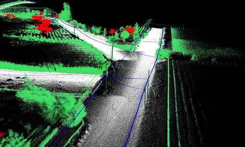
Case study: LiDAR mobile mapping system used to plan upgrade of powerlines
A powerline survey was performed to upgrade out-of-date copper distribution lines in British Columbia, Canada. The LiDAR data was used to create a 3D digital view of the roads and electricity assets to allow detailed planning of the works and the materials needed.
Read the case study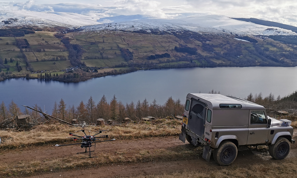
Case study: Vehicle and drone based LiDAR mapping protects Scottish woodland.
The aim was to collect and process survey data to develop a plan to manage a forest under threat from an approaching plant pathogen. The rich dataset enabled the team to identify surface hazards, assess slope stability impacts, develop a felling plan and design a drainage plan.
Read the case study