
LiDAR mapping Quality Assurance
To reduce errors and achieve quality results.

Quality Assurance and Quality Control as standard
Routescene has a strong ethos of Quality Assurance (QA) and Quality Control (QC). We have embedded this across our workflow, our systems and software ensuring you gain the best results possible.
Why do I need Quality Assurance and Quality Control?
You need to demonstrate the reliability of the data you have collected and that you have the utmost confidence in it. Quality Assurance and Quality Control are essential to ensure the data delivered to the end customer is as accurate as possible and the level of accuracy can be proven.
QA\QC are expected in surveying and should be an integral part of your data acquisition and data processing procedures. How rigorously this is applied and exactly what you do will depend on the level of data quality you need to produce your final output.
Your QA/QC process should enable you to identify and minimize potential errors before you start your survey; and during your survey enable you to recognize errors as soon as possible and decide on a remedy. This is particularly important during the data collection phase of difficult or remote surveys so you can solve the issue before you leave the site. During data processing the QA/QC processes you employ are equally important to ensure you keep the integrity, accuracy and resolution of the data during your analysis.
Routescene QA/QC components
QA Monitor: real-time survey mission monitoring web application
Ground Control Targets: to improve accuracy and provide QA
Post processing tools for system calibration
Data processing tools to improve and verify accuracy
Generate a Quality Assurance Report to ASPRS standards
QA Monitor web app: Real-time survey mission monitoring
For continuous real-time in-flight data monitoring, using QA Monitor you can make sure you leave the survey site with the data you need.
Simple to use, this web based app gives you confidence in the data you are collecting while you are collecting it. Accessed using a web browser from a tablet, mobile phone or laptop which has a Wi-Fi connection, QA Monitor receives and displays real-time Status and Quality Assurance data for:
- LidarPod GNSS / INS
- LidarPod LiDAR sensor
- RTK Ground Station
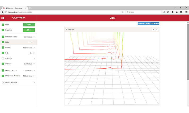
QA Monitor survey mission monitoring web app
Ground Control Targets: Improve accuracy
Routescene advocates that every survey has ground control established to provide an independent check of your results.
Setting ground control helps to demonstrate a certain level of accuracy has been achieved. It also avoids data processing issues and assists with the calibration of the sensors on the drone: all of which improve the confidence in the accuracy of the survey. Using Routescene’s Ground Control Targets you can easily and quickly establish ground control.
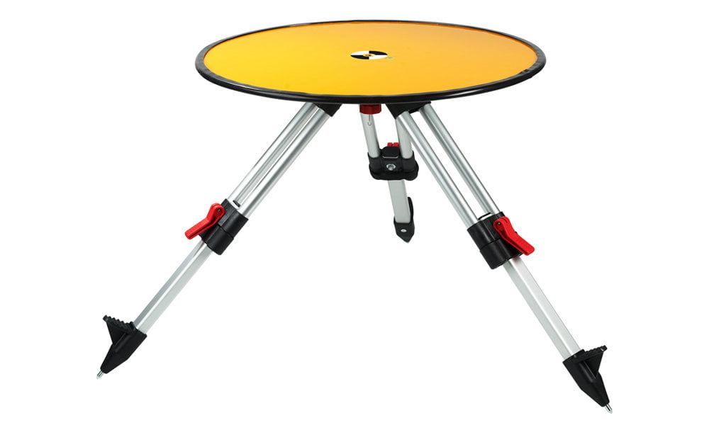
Routescene LiDAR Ground Control Target
Data processing: To improve and verify accuracy
Using our data processing software you can produce a Quality Assurance Report to ASPRS standards for every survey you perform to verify your results. This enables you to demonstrate to your end client that the data collected is to the required specification.
The data processing QA/QC steps are:
- Confirm point cloud accuracy:
- Import Ground Control Target (GCT) locations.
- Automatically identify and extract the points associated with the GCT from the point cloud and compare them against their known coordinates.
- Quantify the accuracy that has been achieved.
- Calibration of system:
- Boresight alignment.
- Strip alignment.
- Compare different point cloud datasets using multiple layers to establish correlations across the data.
- Establish repeatable workflows to enable outputs to be measured and quantified.
- Generate your Quality Assurance Report.