
Easily collect and process LiDAR 3D mapping data
Reliable 3D mapping solutions and software
At Routescene we look beyond the point...
...we create integrated LiDAR 3D mapping solutions and software to solve real problems.
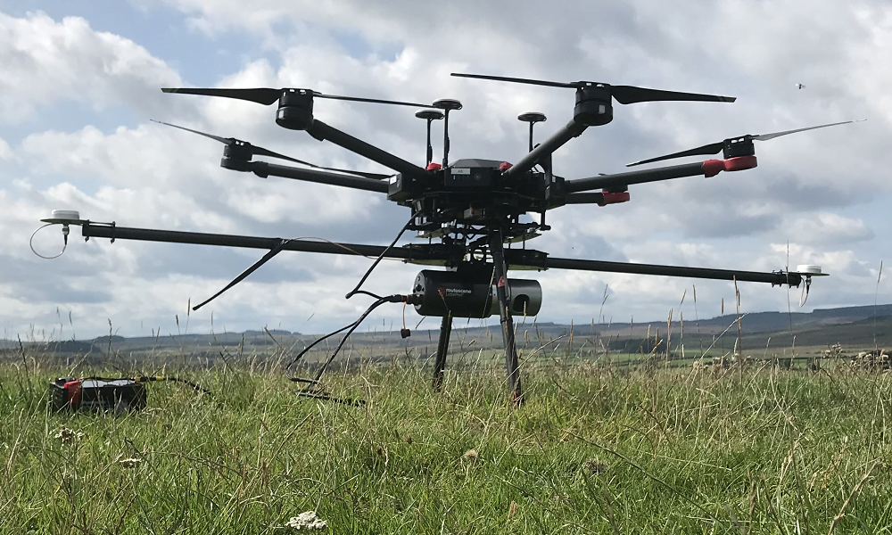
UAV LiDAR Systems
The Routescene drone LiDAR mapping solution includes hardware, data processing software, QA software, extensive training and support packages.
Features
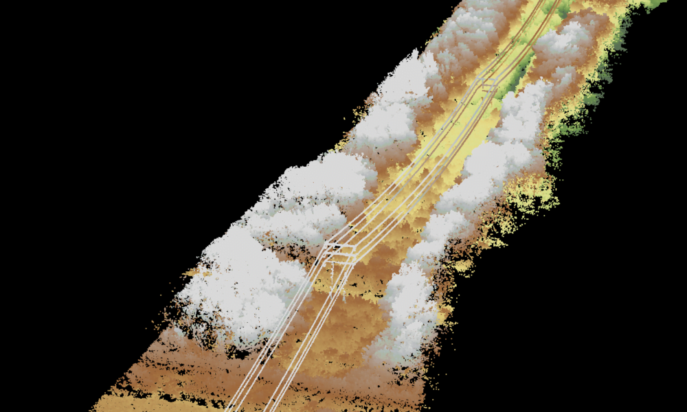
Data processing software
3D LiDAR mapping software to visualize and process LiDAR data to deliver final outputs. Using our software you can vastly reduce your LiDAR data processing time.
Features
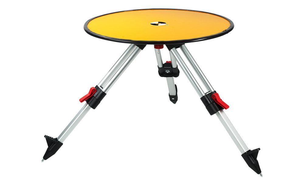
Ground Control Targets
Specially designed for UAV LiDAR surveys to verify ground control, improve accuracy and demonstrate the level of accuracy achieved.
Features
Designed by surveyors, our end-to-end systems and software solve specific industry problems, save time, improve efficiencies and increase productivity.
We’ve made it simple for you. Our solutions give you everything you need to get the job done – workflows, post processing software, hardware, quality assurance software, training and support. There are options to suit your performance and price requirements and we can help you choose the best system for your application.
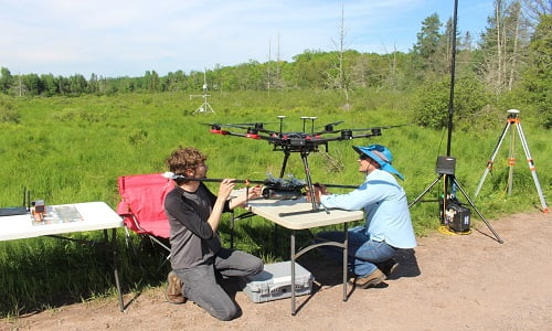
Case study: LiDAR forestry surveys to inform carbon reduction policies
This forestry project in Northern Wisconsin, USA, undertaken by the University of Wisconsin-Madison (UW-Madison), employed a Routescene LiDAR payload on an Unmanned Aerial System (UAS/drone) to characterize the forest canopy structure and determine the dominant tree species.
Read the case study5 reasons to select Routescene for your LiDAR 3D mapping system and software

End to end solutions
We’ve thought through everything to help you save time and improve productivity.
Confidence
Created by surveyors for professionals. 30+ years’ experience are behind our proven, reliable products.
Workflows
Embedded across survey planning data capture and data processing, our workflows improve productivity.
Quality Assurance built in
Our QA/QC process spans both the acquisition and processing of your LiDAR data to ensure you gain the best results possible.
Training and support
Achieve optimal results and quickly with comprehensive training, online resources and responsive technical support.


Applications
Integrated LiDAR systems and software for a diverse range of survey and mapping needs.

Survey and mapping
Our systems and software have been created by surveyors for professionals.
Benefits


"I have used the Routescene UAV LiDAR survey system for 4 years now and have been very pleased with the LiDAR system and personalized support. The Routescene LidarPod is very reliable even when deployed in the extreme and remote environment of northern Alaska."
Christian Andreson University of Wisconsin, USA