5 reasons to select Routescene for your LiDAR mapping system
Posted on September 9, 2025 in Help and UAV LiDAR
We understand it can be confusing when comparing the various UAV / drone LiDAR mapping systems available on the market to choose the one that’s best for you. Of course... Read more

Ground Control Frequently Asked Questions
Posted on August 1, 2023 in Ground Control Targets and Help
Our Frequently Asked Questions about Ground Control provide insight into why it’s important and how to establish it. If you have a question we’ve not covered please do get in... Read more
Why do I need dual GNSS heading?
Posted on July 20, 2023 in Accuracy and UAV LiDAR
This guide explains what heading is and why you need dual GNSS heading for UAV LiDAR surveys. What is heading? The term “heading” describes the current direction in which the... Read more
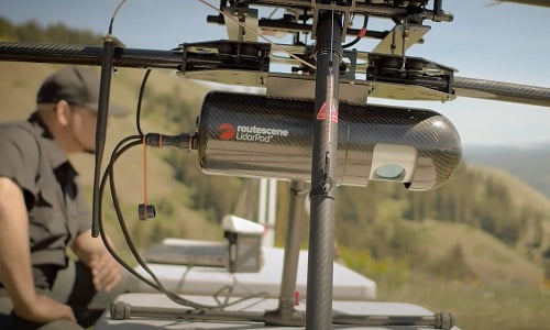
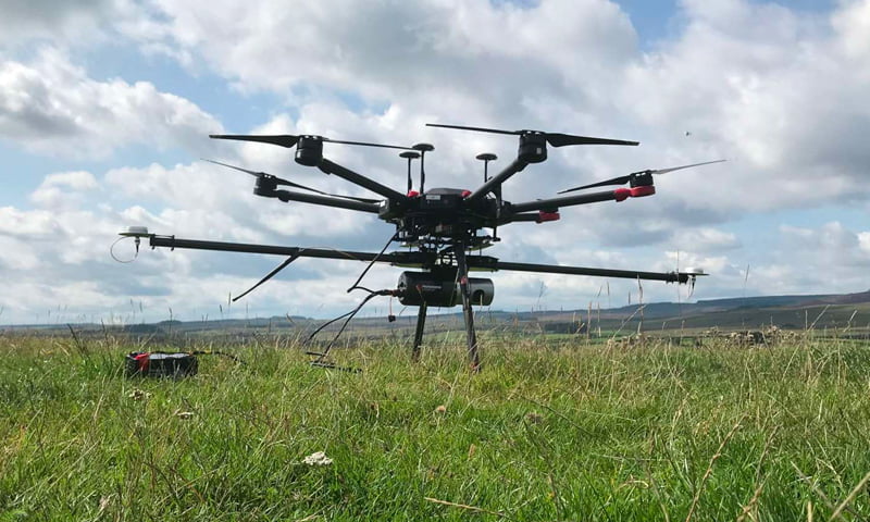
Recommended UAV drones for Routescene LiDAR mapping systems
Posted on June 28, 2023 in Drone integration and UAV LiDAR
Routescene’s UAV LiDAR mapping systems have been designed to be drone agnostic. Easily integrated with any multi rotor drone that can carry a payload of between 1.9kg / 4.2lb and... Read more
UAV LiDAR Frequently Asked Questions
Posted on February 24, 2023 in Help and UAV LiDAR
Our Frequently Asked Questions give you more in-depth information about LiDAR and UAV LiDAR – how it works and when you would use it. If you have a question we’ve... Read more
Glossary
Posted on July 20, 2022 in Help
Routescene’s dictionary to demystify UAV LiDAR terms To help you understand UAV LiDAR and data processing language, here’s a glossary of commonly used geospatial, UAV survey, LiDAR and data processing... Read more
What is UAV LiDAR?
Posted on May 25, 2022 in Help and UAV LiDAR
In a series of articles, we’ll answer the frequently asked questions about UAV LiDAR including how it works, the alternatives, the benefits and the best applications for the technique.
Predictions for UAV / drone LiDAR in 2022
Posted on January 15, 2022 in UAV LiDAR
As an early entrant in the UAV / drone LiDAR market, Routescene has been developing systems since 2013. We have observed a huge change in the market during that time... Read more
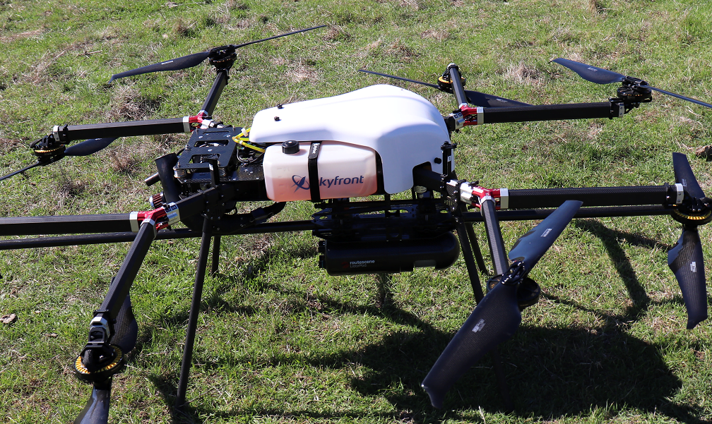
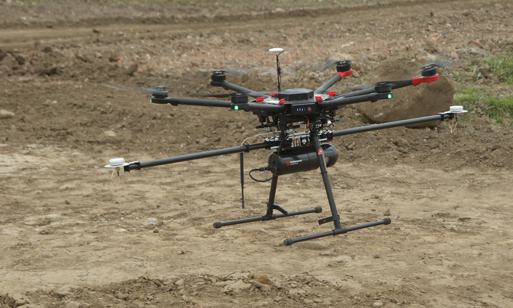
Considerations when choosing your LiDAR drone mapping platform
Posted on June 9, 2021 in Drone integration and UAV LiDAR
We recognize that every customer has their own preferences for the Unmanned Aerial Vehicle (UAV) they like to use. Payload, flight performance (duration and speed), fuel type, type of drone... Read more
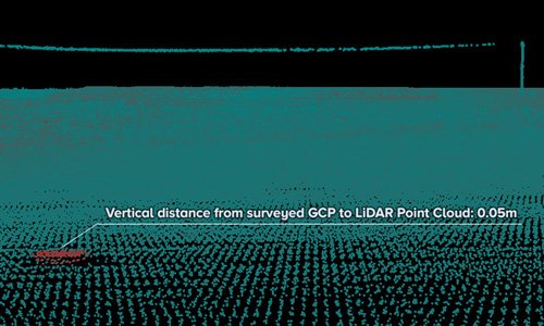
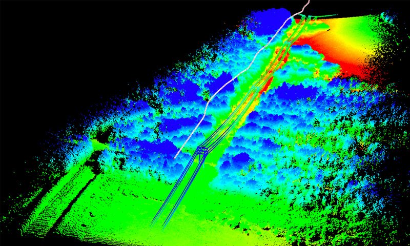
LiDAR Mapping accuracy explained
Posted on April 28, 2021 in Accuracy, Help, UAV LiDAR, and Vehicle LiDAR
Exploding the LiDAR Mapping accuracy myths There is a continual conversation across the LiDAR Survey & Mapping community about accuracy, what it means and how important it really is. As... Read more
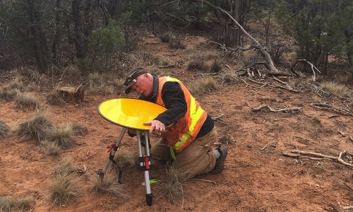
Improving UAV LiDAR survey accuracy using Ground Control Targets
Posted on January 10, 2021 in Accuracy, Ground Control Targets, and UAV LiDAR
Developing Quality Control & Quality Assurance for UAV LiDAR The survey and mapping industry has experienced phenomenal growth with the number of surveys conducted using UAV LiDAR continuing to increase.... Read more