
Utilities and infrastructure
Corridor and asset mapping and management.

High resolution systems for asset location and vegetation management
Infrastructure and energy management is crucial. Poor management can result in safety, environmental, legal and economic issues.
Industry-specific uses of LiDAR 3D mapping in the Utilities and infrastructure sector include:
- vegetation management along powerlines, overland pipelines, rail or road
- wildfire mitigation
- preparation for extreme weather
- asset location of powerline, telecoms, overland pipes, rail, road.
Regular corridor mapping to identify vegetation encroachment can reduce the number of power outages and wildfires. Routescene offer high resolution LiDAR Systems to geo-locate assets, determine powerline sag and identify vegetation for removal.
Why the Survey and mapping sector chooses Routescene products
System options to suit vegetation management and asset location applications
Carefully thought through workflows to improve productivity and rate of return
Data processing: deliver digital outputs direct to your customer
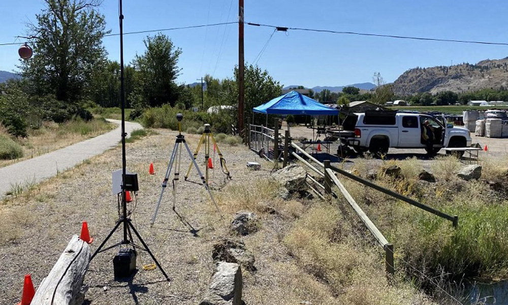
Case Study: LiDAR mobile mapping system used to plan upgrade of powerlines
A powerline survey was performed to upgrade out-of-date copper distribution lines in British Columbia, Canada. The cable replacement work would improve the efficiency of the electricity supply across the neighborhood. The LiDAR data captured was used to create a 3D digital view of the roads and electricity assets to allow detailed planning of the works and the materials needed.
Read the case study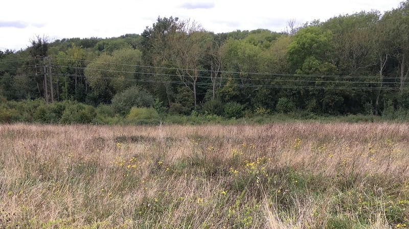
Case Study: Improve powerline vegetation management using UAV LiDAR
Local power outages are often due to trees and vegetation encroaching or falling onto powerlines. In addition, extreme weather events and natural disasters affect the stability of trees and vegetation, and can impact on a wider scale. The aim of this powerline vegetation management project was to identify where vegetation was encroaching the powerline to prevent outages and to identify which trees may fall due to poor health and cause damage to the powerline.
Read the case studyRoutescene products for the Utilities and infrastructure sector

UAV LiDAR Systems
The Routescene drone LiDAR mapping solution includes hardware, data processing software, QA software, extensive training and support packages.
Benefits

Data processing software
3D LiDAR mapping software to visualize and process LiDAR data to deliver final outputs. Using LidarViewer Pro you can vastly reduce your LiDAR data processing time.
Benefits

Ground Control Targets
Use for LiDAR and photogrammetry UAV surveys to improve accuracy and demonstrate the level of accuracy achieved.