Powerline mapping to improve supply efficiencies
Electricity distribution company Fortis wished to upgrade out-of-date copper distribution lines in a neighborhood within the small, rural town of Oliver, British Columbia, Canada. The cable replacement work would improve the efficiency of the electricity supply across the neighborhood.
Fortis did not have an up-to-date view of their existing powerlines and needed to establish what assets they had and their locations in order to plan. Routescene customer Rekon Solutions Inc, professional LiDAR drone service provider, undertook a powerline survey combining both vehicle-based LiDAR mobile mapping system and UAV-based LiDAR. The data was used to create a 3D digital view of the roads and Fortis assets to enable detailed planning of the works and materials needed.
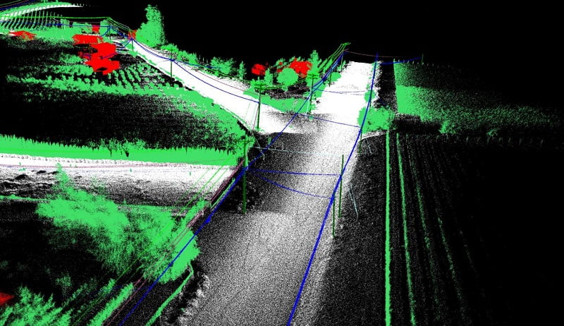
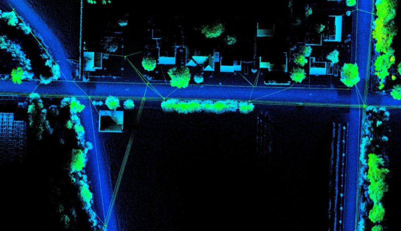
The resulting point cloud data used to plan the distribution line upgrade
LiDAR mobile mapping versus drone based mapping
Vashaun Henderson, Operations Manager at Rekon, had initially planned to conduct LiDAR surveys of the area using their Unmanned Aerial Vehicle (UAV) with the Routescene RS4 LidarPod mounted underneath. However Vashaun confirmed, “Once we took a look at the neighborhood we realized we could collect 95% of the data easily using the truck mounted LiDAR mobile mapping system. The Routescene system has the benefit of being either mounted on the truck or used as a UAV payload. The choice is ours depending on the conditions. Being closer to the road and to nearby assets in the vehicle meant we would collect even more accurate data. We identified one area close to the river where it was more appropriate to use the LiDAR system on the drone.”
Using this combination of vehicle and UAV based data collection allowed Rekon and their client to save money and time during this project.
Ground control and data collection
Unlike photogrammetry, LiDAR is not affected by light conditions or shadows and can be collected quickly and easily from the safety of a moving truck. This gives the flexibility to survey at night, particularly useful for highway projects when traffic is lighter. Routescene’s LiDAR mobile mapping system includes a roof rack which has a specially developed shock absorption system to reduce vibrations from an uneven road surface. This allows the best possible results to be obtained.
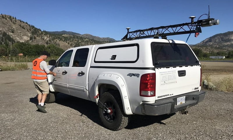
Routescene’s Vehicle LiDAR system deployed on the truck
During August 2020, in temperatures of 40°C, the Rekon team partnered with survey company Allterra Land Surveying to undertake the survey. Allterra prepared all the ground control points the day before the survey, which were used to calibrate for drift, which is typical in a longer vehicle survey.
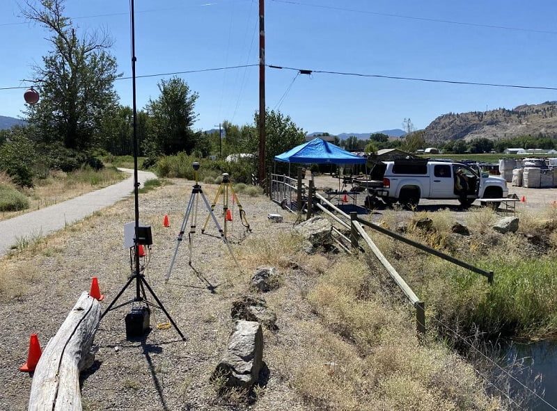
Routescene Ground Station set up
Vashaun commented, “You do have to be very careful when flying the drone near powerlines. This was reinforced when we saw a goose from a flock, which was flying nearby, hit and arc the power line and fall into the river like a roasted turkey.”
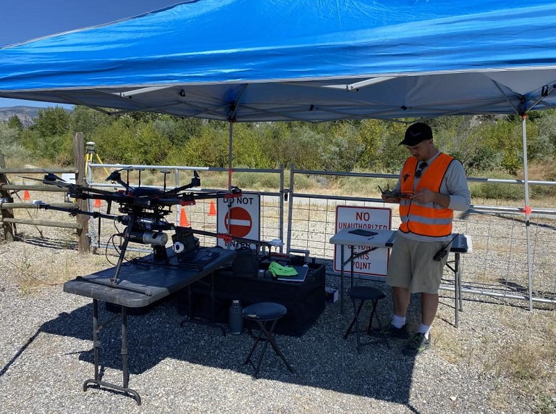
Preparing the drone and Routescene LiDAR system for take off
Monitoring data quality in real-time
Quality control was important to ensure the right data was collected and that it was of good quality. During the powerline mapping survey, the LiDAR scanner, INS and GNSS within the system were constantly monitored from inside the truck using Routescene’s QA Monitor software. This ensures the system is set up properly and is collecting good quality data throughout the survey. At the end of the survey the data was also checked using Routescene’s LidarViewer software. This prevents repeat visits to sites and delays to projects. As a result of this quality control only one pass through the neighborhood was required with the truck.
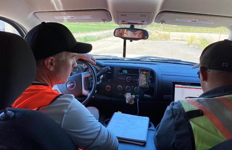
Live monitoring of the LiDAR data collection from the comfort of the air conditioned truck
Accurate and high resolution data to identify power lines
The LiDAR sensor within the Routescene mobile mapping system provides up to 1.4 million 3D points per second in dual return mode. 4.9km of road was covered with a total of 950,854,243 points processed. The average number of points per square meter was over 1,400 which provided incredibly detailed results. The vertical error was just 1.9cm.
This high resolution data showed not only the roadways and surrounding features such as trees and telegraph poles but also the fine details such as road curbs and manhole covers. The team was able to identify electricity poles, guy ropes, the sag of electricity lines, electricity entry points into houses and many more useful features.
Watch this video to see how the data is visualized in Routescene’s LidarViewer Pro processing software:
The LiDAR street mapping data was aligned with the location and orientation of the ground control points to establish absolute accuracy.
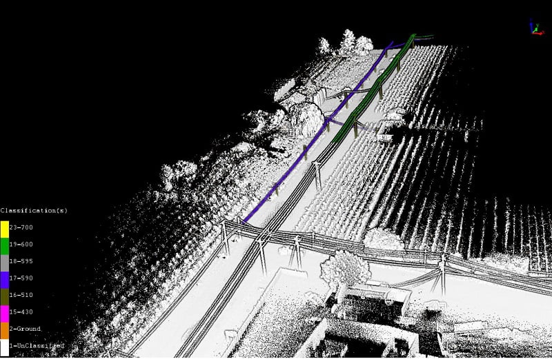
The point cloud was cleaned to remove noise and processed in LidarViewer Pro. Using specialist software the team classified the features of interest. Fortis were provided with separate LAS files of a Digital Elevation Model and a Digital Terrain Model of the neighborhood to be upgraded. Distribution lines, neutral lines, fiber optic overhead lines, anchor and guy lines, structure and poles, vegetation and roads lines were classified and exported. Rekon provided the results in x, y, z format for Fortis to further analyze in specific power line software packages.
Transmission line LiDAR data classified
Classified powerline LiDAR data in third party software
This is a great example of how we were able to provide the client with incredibly detailed information on the location of their power line assets. Using the vehicle based LiDAR system and the UAV where required allowed the client to save money and time in planning the update of electricity lines to the community. We were able to provide quickly and efficiently highly detailed 3D geo-referenced information. It would have taken considerable amount of time and cost to gather this data any other way.”
Vashaun Henderson, Rekon Solutions, British Columbia, Canada
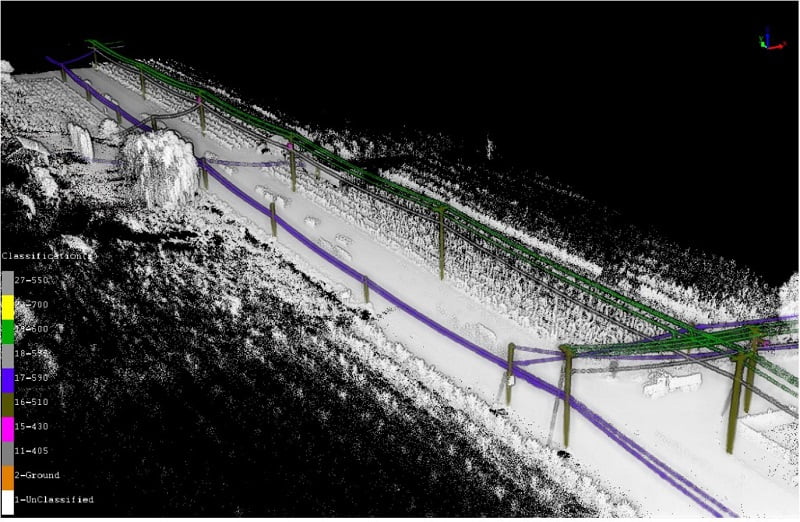
Classified powerline LiDAR data ready for the client
To summarize, be prepared
Rekon are experiencing an increased demand for their LiDAR vehicle mapping services.
Vashaun added, “Since this LiDAR transmission line project if there is a possibility that we could use the vehicle mobile mapping system for a project, we now always fix the roof rack system to the truck. It never hurts to take it along, just in case. We protect all the sensors from grime from the road during transport to and from the site. With the vehicle mobile mapping system you can collect a huge amount of data. We collected all the vehicle based data for this project in just one hour. With the drone we are limited by battery life to 15-20 minute individual flights.”
See how Rekon promoted this project with a short video on Instagram:
View this post on Instagram