Utilities
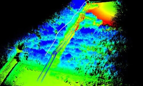
Improve powerline vegetation management using UAV LiDAR
Posted on October 4, 2021 in Forestry, Research, Survey & mapping, UAV LiDAR, and Utilities
This is the sixth in our series of forestry related case studies to demonstrate the superior capabilities of the Routescene UAV LiDAR system for forestry management use. This LiDAR powerline... Read more
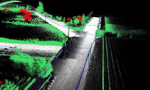
LiDAR mobile mapping system used to plan upgrade of powerlines
Posted on June 14, 2021 in Survey & mapping, UAV LiDAR, Utilities, and Vehicle LiDAR
Powerline mapping to improve supply efficiencies Electricity distribution company Fortis wished to upgrade out-of-date copper distribution lines in a neighborhood within the small, rural town of Oliver, British Columbia, Canada.... Read more
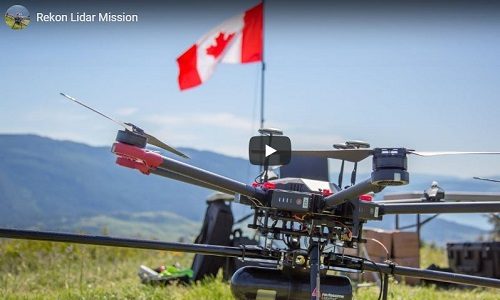
Transmission line survey using LiDAR for drones system
Posted on September 16, 2019 in UAV LiDAR and Utilities
LiDAR for drones use case by Rekon Solutions Watch the video as Routescene customer Rekon Solutions Inc set up and fly their UAV LiDAR System on their drone. The survey... Read more