
Survey and mapping
Achieve precision and efficiency using LiDAR mapping and software.

Created by surveyors for professionals
We have applied 30+ years’ experience across surveying, LiDAR, GIS, dynamic data capture and data management to develop our systems and software.
Using LiDAR systems on drones and data processing software:
- saves time
- is cost effective
- creates a safer working environment
- delivers high spatial resolution and accuracy
- provides superb vegetation penetration capabilities
- streamlines processes and brings efficiencies
Drone LiDAR technology is changing the approach to surveying. Typical projects include land use planning, for residential, commercial, industrial, or mixed use areas; planning for greenways and recreational areas; to infrastructure development.
Why the Survey and mapping sector chooses Routescene products
Survey and mapping grade options to suit your performance and price requirements
Quality assurance as standard to reduce errors and achieve quality results
Data processing: multiple layers functionality to build a complete picture of your survey site
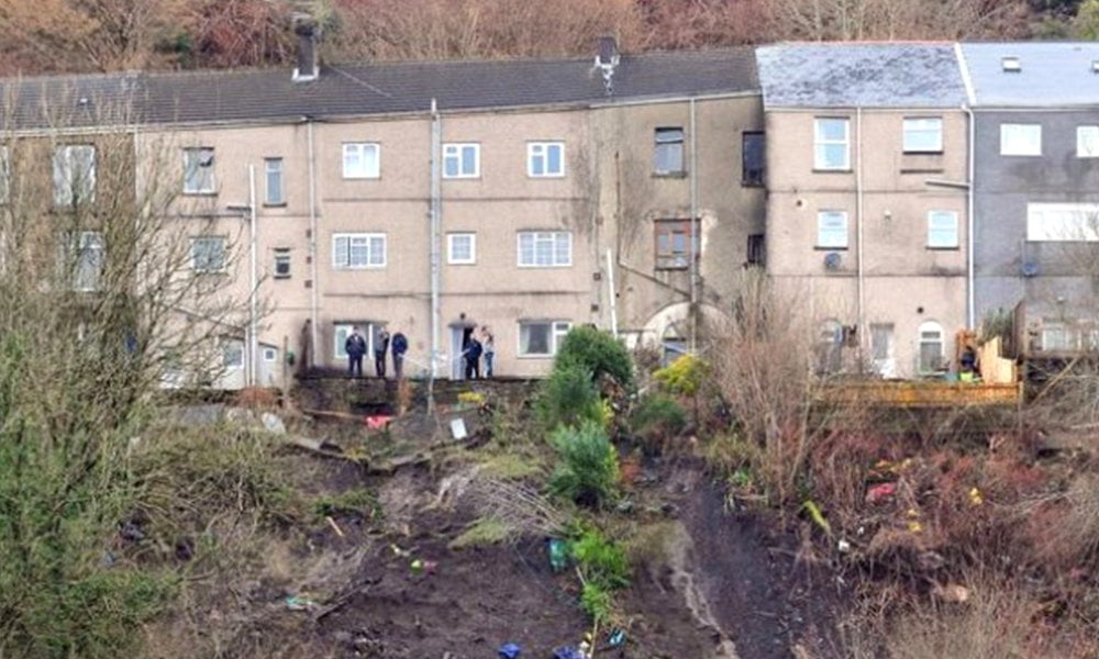
Case Study: Using UAV LiDAR to monitor landslides safely
This case study explains how Routescene's UAV LiDAR system was used in a hazardous environment to keep personnel safe. Multiple surveys were repeated over time and the resulting data was processed to generate Digital Terrain Models (DTMs) using Routescene's data processing software. The DTMs were compared to assess the rate and scale of land movement. The final report enabled the local authority to make decisions about people's homes and safety.
Read the case study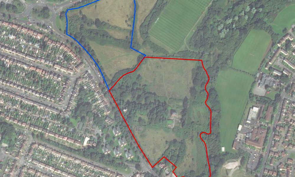
Case Study: Using LiDAR UAV mapping system to locate, identify and preserve old trees
A drone LiDAR survey was undertaken on a potential development site for new housing, to identify and protect the next generation of ancient trees and inform a vegetation clearance plan. The LiDAR dataset was processed in Routescene's post-processing software. Detailed contour maps were created to assess the variations in ground level across the site. The basal area of each tree was calculated to identify trees with a diameter in excess of 100mm for preservation.
Read the case studyRoutescene products for the Survey and mapping sector

UAV LiDAR Systems
The Routescene drone LiDAR mapping solution includes hardware, data processing software, QA software, extensive training and support packages.
Benefits

Data processing software
3D LiDAR mapping software to visualize and process LiDAR data to deliver final outputs. Using LidarViewer Pro you can vastly reduce your LiDAR data processing time.
Benefits

Ground Control Targets
Use for LiDAR and photogrammetry UAV surveys to improve accuracy and demonstrate the level of accuracy achieved.