A UAV LiDAR mapping system has many different applications – this one was specifically to protect the next generation of ancient trees. Using the Routescene UAV LiDAR System the FlyThru team used drone land surveying at a potential building site to establish the position and size of all the trees across the location. The results were used to establish which trees would remain and which would be cleared. As a result of this project many trees that have stood for over a hundred years were protected.
Overgrown site earmarked for housing development
In August 2019 the FlyThru team were instructed by WYG Environmental and Planning to survey a site at the Old Water Pumping Station, Whitley, near Coventry in the UK. The site is jointly owned by two companies which had plans to develop the site for housing. The area was extremely overgrown with dense willow, bramble, as well as mature and well established deciduous and conifer trees, some of considerable size.
The aim of the survey was to identify trees with a trunk diameter in excess of 100mm. The results of the survey would enable a site clearance plan to be developed.
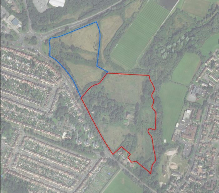
The survey site
Preparing the survey site
To enable the project to take place, Coventry Airport helpfully provided permission for the team to fly UAVs (Unmanned Aerial Vehicle) within their no-fly zone. Once access was gained to the site, ground control was established. The drone LiDAR survey was straightforward and performed in three overlapping surveys. Photogrammetry was also gathered on the same day.
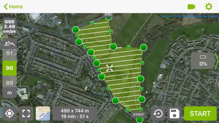
Illustration of the UAV flight planning
LiDAR and drone land surveying to locate and size trees
Due to the dense tree and vegetation coverage across the site it was clear that the best survey technique to deploy was a LiDAR system on a drone. The team used their Routescene UAV LiDAR mapping system on their rotary UAV flying at an altitude of 40m over the site. The system uses lasers to scan an area collecting data at a rate of over 1.4 million points per second. These lasers can penetrate through the different layers of vegetation from the top of the tree canopy down to the ground, achieving over 400 hits (known as points) on the ground per square meter. This detailed data enabled the team to easily locate and size each tree.
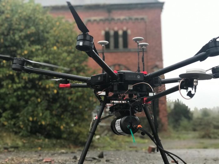
The Routescene LidarPod mounted underneath the drone
The resultant point cloud data was post processed in LidarViewer Pro, specialist LiDAR software developed by Routescene, to create detailed contour maps and calculate the basal area of each tree. The developers used the contour maps to understand the varying ground levels across the site, which were difficult to ascertain with the naked eye due to the thick undergrowth.
Combined LiDAR and photogrammetry data used for tree identification
To enable the arboriculturists to identify individual trees by species the foliage and canopy shape can be assessed. The FlyThru team collected UAV photogrammetry at a height of 60m. The powerful combination of these high definition images with the high resolution LiDAR point cloud data allowed the tree identification task to be rapidly completed.
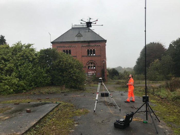
Set up near the Old Pump Station showing dense brambles and ground cover
Processing the data
The FlyThru team carried out considerable data processing to locate each tree as seen in the diagram below.
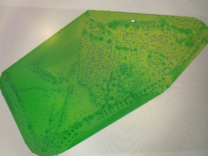
The location of each tree across the site
Summary
This case study illustrates the value of drone land surveying to planners wishing to repurpose old and overgrown sites for building development. Using a combination of UAV LiDAR and photogrammetry the FlyThru team worked quickly and efficiently without disturbing the ecology. The detailed LiDAR data enabled the team to identify trees over a century old for preservation. Creating a contour map of the heavily vegetated site, using the LiDAR data, highlighted that considerably more soil would need to be removed than had been initially estimated to make the site level. As a result the client was made aware of this additional task and cost much earlier.
Using LiDAR on a UAV was an extremely efficient surveying methodology in these conditions. A UAV LiDAR mapping system is ideal in areas of dense vegetation. It would have taken a considerable amount of time to survey the overgrown site by conventional means. This project showcases the benefits of using both UAV LiDAR and photogrammetry survey methods together to produce detailed and definitive results.”
Michael May from FlyThru, UK