
Drone mapping systems - Hardware
We provide all the hardware you need to collect your survey data.

What hardware is included with a Routescene UAV LiDAR system?
We supply a turnkey solution for immediate operation.
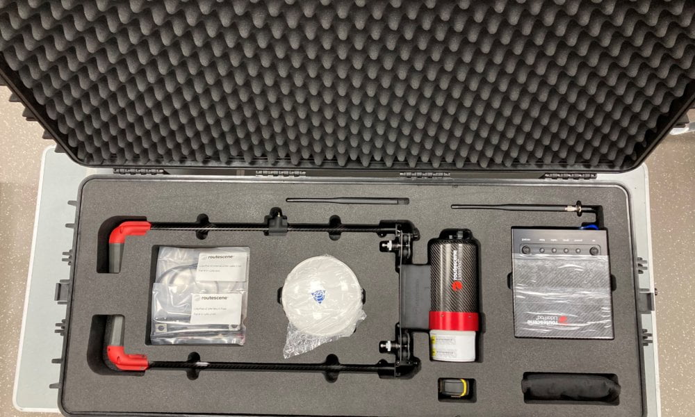
There are 8 main hardware components in each system:
LidarPod with dual heading GNSS
The “LidarPod” is the integrated 3D mapping tool. It is a self-contained unit which includes a LiDAR sensor, RTK GNSS/INS sensor, data storage and radio telemetry.
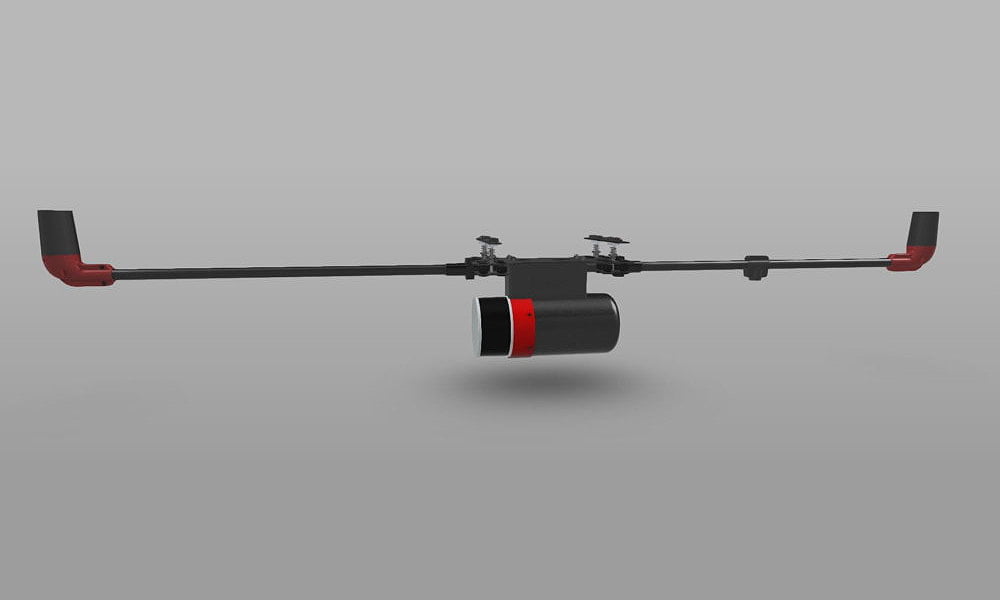
Routescene "LidarPod" design with integrated GNSS antenna and antenna poles
Available in a number of configurations, you can choose from a range of LiDAR sensors and GNSS/INS sensors to suit your performance and price requirements.
Also included are 2 LidarPod GNSS antenna and antenna poles to provide a high accuracy dual heading solution and a UAV radio telemetry antenna to enable remote control of the LidarPod direct from the Ground Station.
Hinged, foldaway GNSS antenna poles for quick deployment in the field
For ease of use the 2 hinged GNSS antenna poles are integrated into the LidarPod unit. No assembly needed and no tools are required.
Ground Station with optional RTK GNSS receiver
The Ground Station is an essential component of the package and enables the command and control of the LidarPod during the survey. Providing real-time monitoring of the survey mission, it aids the Quality Assurance process and ensures you are immediately alerted of any technical issues that may arise.
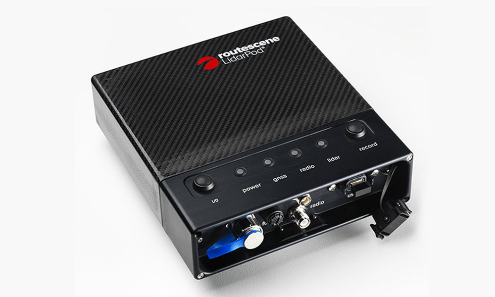
Routescene Ground Station
The Ground Station is constantly in contact with the LidarPod via the in-built radio telemetry and can send RTK corrections to the LidarPod (optional). For Quality Assurance purposes status information is transmitted by the LidarPod and received by the Ground Station. This status information is visualized in QA Monitor, Routescene’s real-time survey mission monitoring web application.
In normal operation the Ground Station is connected to a radio telemetry mast (optionally supplied) using a standard camera tripod attachment. The mast is extendable to 16.5 feet / 5m to help extend the range of the radio telemetry. An in-built Wi-Fi module acts as the Access Point, so you can use any Wi-Fi enabled device such as a tablet, laptop or mobile phone to connect to the Ground Station and you can access the QA Monitor app using a standard web browser. The Ground Station is robust, lightweight and portable.
The Ground Station can optionally be fitted with a GNSS RTK base receiver, enabling it to transmit RTK corrections to the LidarPod and log the observations for post-processing purposes. This option is ideal if you want the results as soon as possible, prefer not to post-process or do not have any GNSS base stations within 60 miles / 100km of your survey site.
Ground Control Targets (optional)
Deploying Ground Control Targets on known Ground Control Points prior to a UAV LiDAR survey provides the assurance that the survey has been properly executed.
Routescene LiDAR Ground Control Target
UAV Mounting Solution
Our new mounting system design including 4 sliding, quick release connectors means it is simple and fast to mount a LiDAR System onto a drone. The mounting kit is specially designed to dampen the vibration from the UAV. Made from carbon fiber, it is lightweight can be integrated onto any multi rotor drone capable of safely carrying a payload of at least 5.5lbs / 2.5kg.
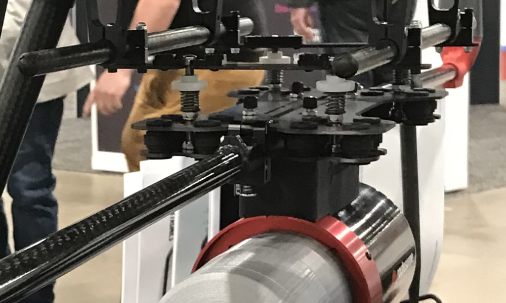
New easy to deploy mounting system design
Peripherals
To enable you to quickly become operational and proficient with the Routescene system we supply:
- Tools and tape measures
- Robust transit cases and tough equipment bags to ship the equipment in an easy manner
- Product and training manuals
- Routescene’s Survey Operating Procedures
Additionally, you can also opt to include the following in your package:
- A dummy system which is the same shape and weight as the real payload, so you can rack up UAV flying practice hours without jeopardizing your new equipment
- Spare LidarPod cables and accessories to ensure minimum downtime
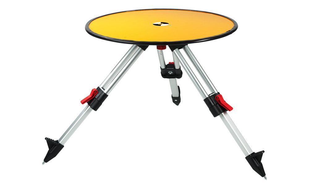
- Survey and radio telemetry tripods
The benefits of a Routescene UAV LiDAR mapping system
Easy to deploy
Portable and easy to deploy. We supply all the equipment (excluding the UAV) for immediate operation.
Robustly engineered
The LidarPod is a sealed unit and no assembly is needed which eliminates user error. Minimal number of external connectors, significantly reducing risk of failure.
Autonomy and security
Our UAV LiDAR solutions do not rely on a mobile phone nor an internet connection to operate. Provides a maximum autonomy, high level of operational and data security.
Weatherproofness
Able to withstand a light rain shower; the LiDAR scanner options are IP67 rated, the LidarPod has IP68 rated connectors and rubber seals to resist water ingress.
Reliable data storage
Internal solid state data storage resistant to vibration in flight and rough handling by users. 12 hours of data collection capacity to fulfil a long UAV or vehicle survey.
Product conformity
Non-ITAR (International Traffic in Arms Regulations) rated so are not subjected to export controls. LidarPod independently CE and FCC certified to ensure it is compliant with electrical and radio transmission standards.