Forest canopy structure characterization using Routescene drone LiDAR system
This forestry project, undertaken by the University of Wisconsin-Madison (UW-Madison), employed a Routescene LiDAR System RS4 on an Unmanned Aerial System (UAS/drone) to acquire high density LiDAR data in the Chequamegon-Nicolet National Forest, Northern Wisconsin, USA. The aim was to characterize the forest canopy structure and determine the dominant tree species. Structure characterization of the forest canopy is a keystone dataset to better understand forest function. The RS4 3D mapping LiDAR system mounted on a drone has the ability to detect and visualize the full tree structure from the top of the canopy right through to the understory vegetation.
CHEESEHEAD project overview
This UAS LIDAR forest survey was part of a wider project to understand how water and carbon interact across a variety of landscapes including forests. The aim of the CHEESEHEAD project, “The Chequamegon Heterogeneous Ecosystem Energy-balance Study Enabled by a High density Extensive Array of Detectors”, was to study interactions and feedbacks between the land surface and atmosphere; and to use the results to improve how these interactions are represented in weather and climate models. The project aims to improve weather forecasting by investigating how vegetation and forest management influence the atmosphere. This information will help decision makers to craft policies to more effectively target reductions in carbon emissions and climate change.
During 2019 from June to October scientists and students from the US and Europe, led by UW-Madison Professor of Atmospheric and Oceanic Sciences Ankur Desai, used flux towers, aircraft, lasers, weather balloons, and drones in the Chequamegon-Nicolet National Forest to test scientific questions about how vegetation influences the weather and climate.
The project deployed a number of flux towers to allow researchers to make measurements across both time and space like never before. The telescoping towers reach as high as 100 feet gathering data on humidity, temperature, greenhouse gases like carbon dioxide and methane, and more. These observations are being used with large eddy simulation and scaling experiments to better understand processes and improve formulations in numerical weather and climate models.
Representation of the type, shape and composition of the forest canopy is a key component for estimation and modeling of forest land-atmosphere water and carbon budgets. Hence the need for a UAS LiDAR forest survey to identify and visualize the different forest tree species and structures in the areas around the flux towers.
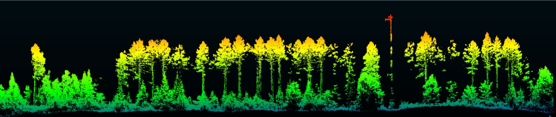
Tree structure point cloud of the main tree species around the flux towers
Study site
The Routescene drone LiDAR system RS4 was deployed in June 2019 within the footprint of CHEESEHEAD site flux towers in Price County, WI, USA.
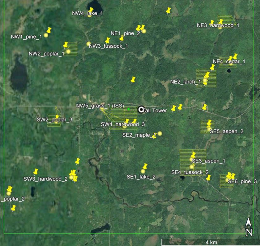
UAV LiDAR flight plans in yellow in the CHEESEHEAD study area. Flux tower sites (circles) and field canopy
The forest drone LiDAR surveys
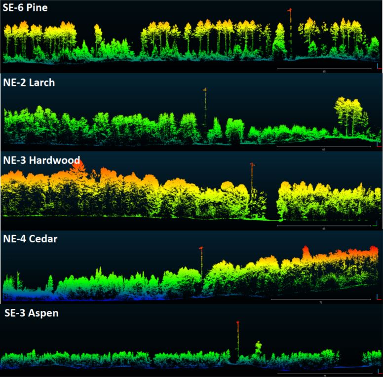
The LiDAR forestry surveys were conducted within the footprint of 11 flux towers and the survey areas ranged in size between 0.25 to 1 square km per site (see table below). Six forest types were targeted including Aspen, Pine, Poplar, Larch, Cedar and Hardwood. This study is the first attempt to characterize forest canopy structure in Northern Wisconsin using a LiDAR UAV mapping system.
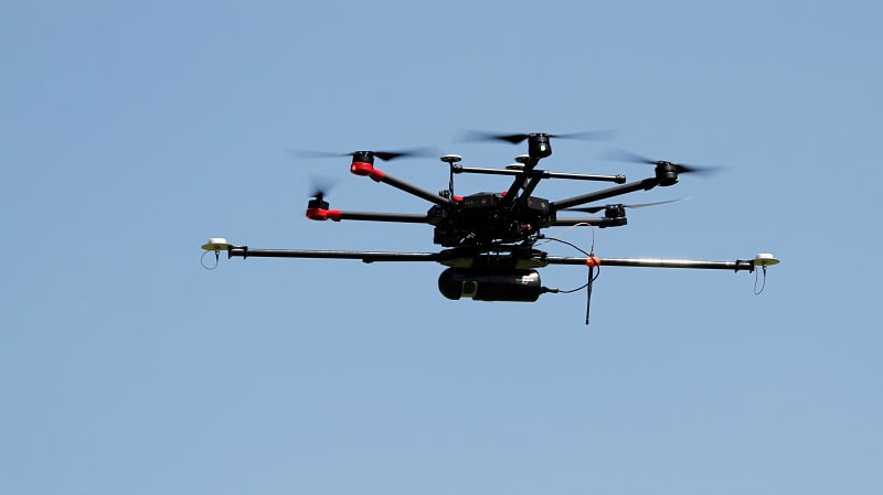
The hexacopter drone was equipped with a Routescene RS4 payload
LiDAR data was collected using a Routescene RS4 LiDAR System, an integrated system which includes a 32 laser LiDAR sensor and GNSS RTK system. The density of the resulting point cloud data averaged 600 points per square meter with a vertical accuracy of 2-5cm.
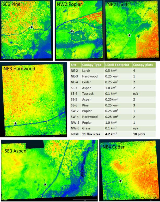
UAS LiDAR forestry point clouds of different sites and canopy types colored by elevation (blue = lower, red = higher. Star indicates flux tower.
Routescene system performed exceptionally well
Christian Andresen from the University of Wisconsin-Madison commented, “The biggest challenge was the flying conditions where the tall canopy (approximately 20-30m) obstructed visibility and we were only able to fly smaller footprints (500m x 500m) within line of sight. Also, we had to be pretty mobile and set up for each of the nine sites.”
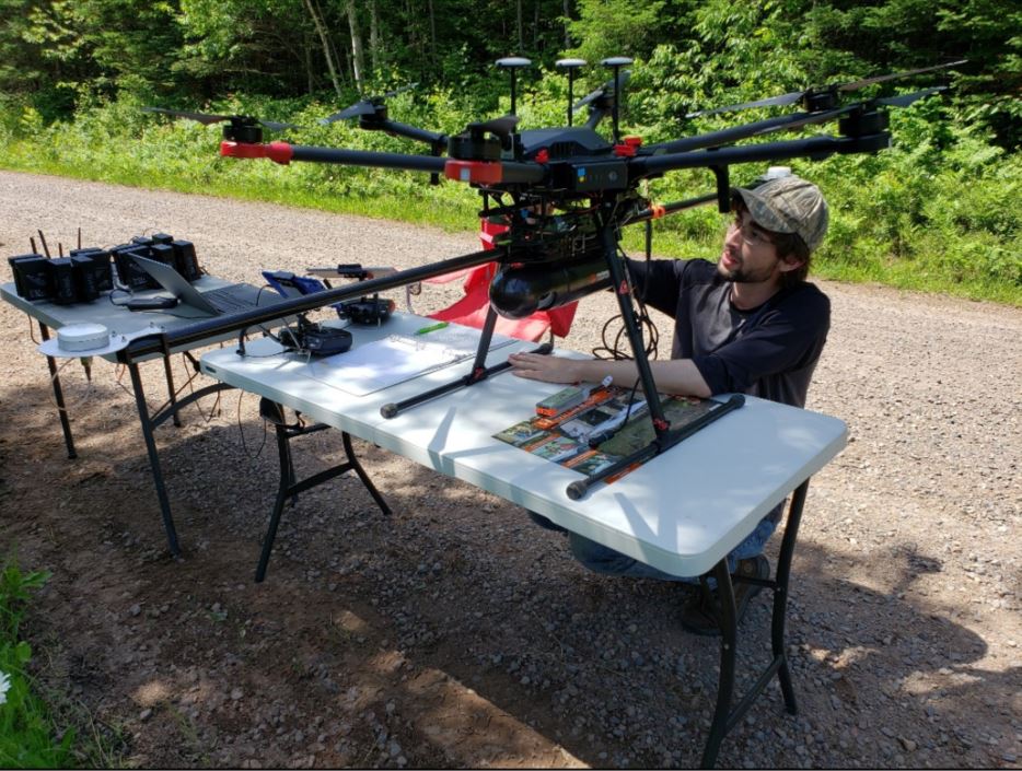
The team collecting UAV LiDAR data using the Routescene RS4 drone LiDAR system
Christian Andresen added, “The Routescene UAS LiDAR system really made it easy for this situation. The system was flawless. With a crew of two people we managed to fly 4.2 km² in 3 days. We achieved all we had planned, we were particularly impressed with the density of overlapping flight lines and the mapping of the forest structure.”
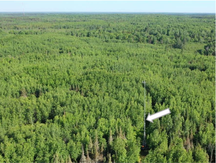
Aerial view of flux tower SE-3 dominated by Aspen. Arrow indicates the location of flux tower
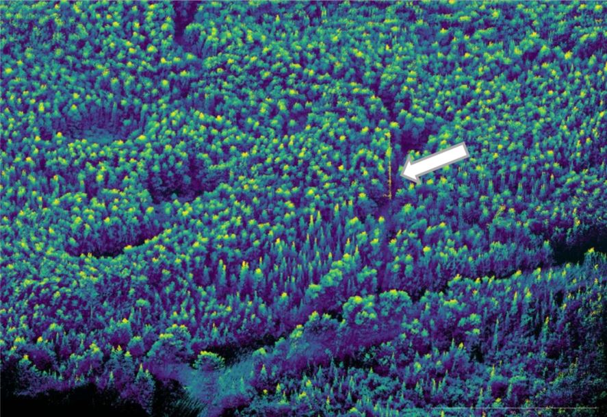
LiDAR point cloud colored by height of area around flux tower SE-3. The arrow shows the location of the flux tower.
Summary
This is the first time a UAV LiDAR system has been used to characterize the forest canopy structure by tree type in Northern Wisconsin. Furthermore, this study has provided a key baseline dataset for up-scaling ecosystem structure and for modeling land-atmosphere gas interactions at a regional level. Leaf-on canopy structure information is also being used to identify surface roughness in the flux footprints of the towers. The spatial data is being used as input drivers for machine learning.
The project contributed to the wider CHEESEHEAD experiment to help generate knowledge that advances the science of surface flux measurement and modeling, relevant to many scientific applications such as numerical weather prediction, climate change, energy resources and computational fluid dynamics.
Future plans from Christian Andresen and the University of Wisconsin-Madison team include:
- Extrapolating LiDAR data and associated ecosystem structure and function to the regional scale using airborne LiDAR data by the Wisconsin Department of Natural Resources.
- Integrating airborne hyperspectral imagery for cover classification and derivation of main structural patterns for tree species.
- Developing a fine-scale classification of LiDAR point clouds by tree species based on structural patterns.
For more information on the CHEESEHEAD project please visit: