
Hardware - Vehicle System
We provide all the hardware you need to collect your survey data.

What is included with each Routescene Vehicle LiDAR system?
We supply a turnkey solution for immediate operation.
There are 5 main hardware components in each system:
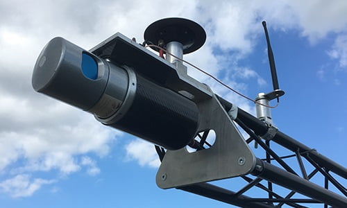
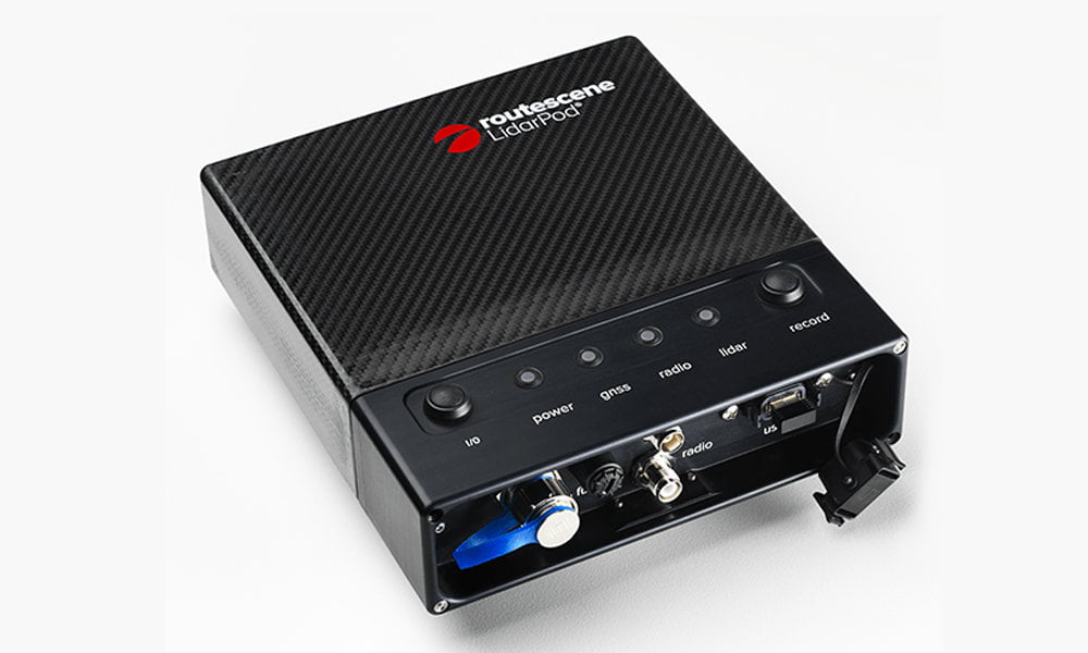
LidarPod©
The “LidarPod” is the integrated 3D mapping tool. It is a self-contained unit which includes a LiDAR sensor, RTK GNSS/INS sensor, data storage and radio telemetry.
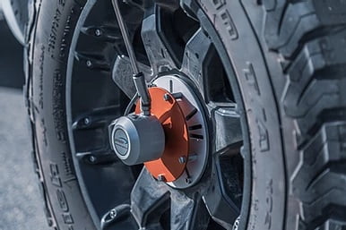
Odometer
The odometer measures the distance traveled by the mapping vehicle. It supplies up to 100 pulses per second to enable accurate distance traveled and velocity to be calculated. This information augments the GNSS\INS solution considerably and reduces drift in urban canyons.
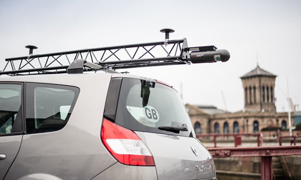
Vehicle support frame
The easy to deploy Routescene LidarPod is mounted on the roof of the vehicle using a light weight aluminium frame. Incorporating advanced coiled suspension mounts to dampen unwanted vibrations and shocks caused by traveling on poor quality roads.
Peripherals
To enable you to quickly become operational and proficient with the Routescene system we supply:
- Tools and tape measures
- Robust transit cases and tough equipment bags to ship the equipment in an easy manner
- Product and training manuals
- Routescene’s Survey Operating Procedures
Additionally, you can also opt to include the following in your package:
- Spare LidarPod cables and accessories to ensure minimum downtime
- Survey and radio telemetry tripods
Do I need a Ground Station?
Not necessarily. This depends on the most practical way to receive RTK GNSS corrections. Your options are:
- Locally using the Routescene Ground Station, or
- Via GPRS modem or satellite, or
- Post process the position data and apply the RTK GNSS corrections after the survey has been completed.
If you decide not to use a Routescene Ground Station, then QA Monitor can be directly accessed using a USB connection between a laptop and the LidarPod.
Routescene Ground Station
The benefits of a Routescene mobile mapping system
Easy to deploy
Portable and easy to deploy. We supply all the equipment for immediate operation.
Robustly engineered
The LidarPod is a sealed unit and no assembly is needed which eliminates user error. Minimal number of external connectors, significantly reducing risk of failure.
Autonomy and security
Our LiDAR solutions do not rely on a mobile phone nor an internet connection to operate. Provides a maximum autonomy, high level of operational and data security.
Weatherproofness
Able to withstand a light rain shower; the LiDAR scanner options are IP67 rated, the LidarPod has IP68 rated connectors and rubber seals to resist water ingress.
Reliable data storage
Internal solid state data storage resistant to vibration during use and rough handling by users. 12 hours of data collection capacity to fulfil a long vehicle survey.
Product conformity
Non-ITAR (International Traffic in Arms Regulations) rated so are not subjected to export controls. LidarPod independently CE and FCC certified to ensure it is compliant with electrical and radio transmission standards.