Routescene Inc use drone aerial LiDAR survey to uncover 750-year-old structures
Posted on February 27, 2019 in News
The culturally rich Canyons of the Ancients National Monument in Colorado have the highest density of archaeological sites in the USA. These sites hold a great deal of historical significance for Ancestral Puebloans and other Native American cultures.
 For the Local Crow Canyon Archaeology Center and the Canyons of the Ancients National Monument mapping the Sand Canyon, an ancestral Pueblo site in this area, presented a number of challenges. They identified the need for a survey that would create a high resolution terrain model of the Sand Canyon Pueblo Site, devoid of vegetations, which could be used for archaeological interpretation.
Aerial LiDAR survey of the land
Through the use of our UAV LiDAR survey technology Routescene, in collaboration with Caddis Aerial, were able to meet all the client’s needs and reveal potential additional structures.
On location, the team deployed the Routescene LidarPod flown using a DJI M600 Pro, the drone executed its’ flight plan and returned to the take-off point after each flight. Three flights were performed to cover the entire site, each flight took 10 minutes, and a total of 24 flight lines were flown to ensure 100% data overlap.
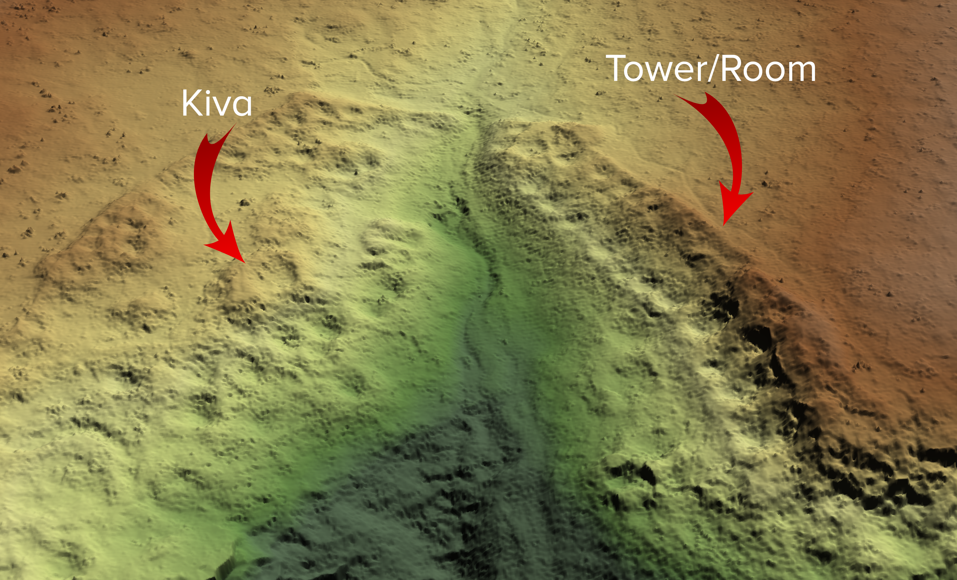
More than 3.2 billion points were collected during this survey, and it was important that the high resolution of the data was maintained during analysis. Using their proprietary software, LidarViewer Pro and their Bare Earth tool, Routescene extracted the bare earth points to create a bare earth terrain model.
“Unlike other aerial survey methods such as photogrammetry, LiDAR can “see through” brush, vegetation and woodland, penetrating the canopy and undergrowth to the earth itself,” says Gert Riemersma, President and CTO at Routescene Inc. “Our 3D mapping solution is stellar for this work, having been used for this purpose many times by customers. We knew it would provide excellent results for the Crow Canyon Archaeological Center and the Canyons of the Ancients National Monument.” The resolution of the final output was an impressive 400 points/m2.”
Surprising results
“The impact of this survey approach is truly astonishing,” says Mark D. Varien, Executive Vice President of the Research Institute at Crow Canyon Archaeological Center. “It illustrated how the tool could be used to record undocumented sites with unprecedented precision. It removed the need for a painstaking ground survey, and the speed of delivery of such detailed results is impressive. It has accelerated our understanding – the results indicate the pueblo was more extensive than we had previously imagined.”