Land mine project – media coverage of Routescene’s project with The HALO Trust
Posted on March 28, 2024 in News
The purpose of this Land Mine Project was to prove the impact UAV LiDAR can make to improve land mine clearance planning.
This work proved that UAV LiDAR can be used to detect battlefield features which can be indicators of minelaying. The UAV LiDAR data collected in Angola provided evidence of trenches, craters and foxholes at all the sites surveyed: features which were either not detectable or only partially visible in satellite imagery, RGB and TIR imagery or from the ground.
Media coverage
The following journals and associations have kindly published articles covering this important Land Mine Project:
LiDAR Magazine (Nov / Dec 2023, Volume 13, Issue 4)
Title: UAV-Lidar improves landmine clearance planning
ARPAS-UK – The UK Drone Association
Title: UAV LiDAR improves land mine clearance planning
“A day in the life of…” article explaining the work of Pedro Pacheco, a GIS Officer and Drone Pilot at The HALO Trust, the conditions they operate in and the challenges they face. Routescene is a member of ARPAS-UK.
LiDAR Magazine (October 2023, Volume 13, Issue 3)
Title: UAV-Lidar improves landmine clearance planning
This article explains how UAV LiDAR’s ability to penetrate vegetation enabled the survey team to map trench extents, bunkers and craters to predict where a mine line may be located.
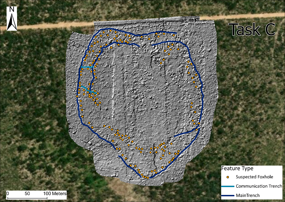
DTM showing predominant battlefield feature types at Site C in Cuito Cuanavale, Angola.
GeoConnexion International (Autumn 2023, Volume 22, Issue 3)
and on GeoConnexion website
Title: How to clear mines using UAV LiDAR
This article discusses the practical challenges and technology needed to use UAVs to plan land mine clearance. The in-field challenges covered include:
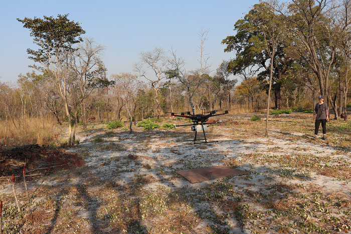
Drone survey take-off and landing site in Angola.
Challenge 1: Ground truthing
Challenge 2: Lack of drone take-off and landing sites
Challenge 3: Productivity
Challenge 4: Optimal data collection times
Challenge 5: Survey planning
Challenge 6: Improve feature identification
GIM International e-magazine (Issue 6 2023 Volume 37)
and on GIM International website.
Title: How UAV Lidar improves landmine clearance planning
This article (page 43) explains the need for exploring UAV LiDAR as a way to improve the detection and mapping of battlefield features. Describing the project from initiation in Scotland in 2020 through to the completion of UAV LiDAR surveys across 3 sites in Angola between 2021-23.
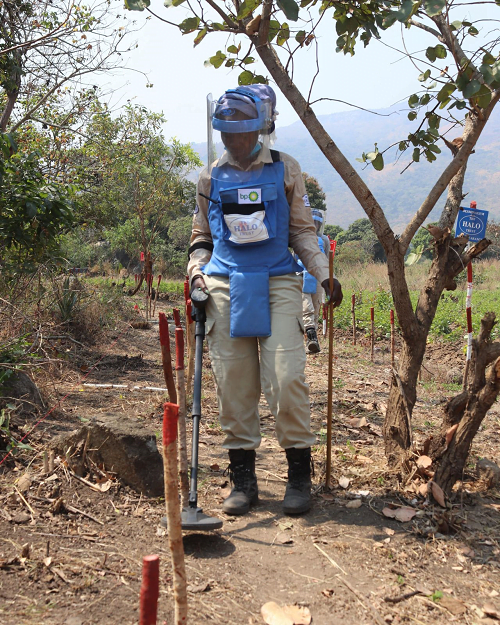
Member of land mine clearance team working in Angola.
The Journal of Conventional Weapons Destruction (Issue 27.2 | Summer 2023)
Published by Center for International Stabilization and Recovery (CISR).
Title: How UAV Lidar Imaging can locate and map minefield features
This article outlines how an unmanned aerial vehicle (UAV) mounted light detection and ranging (LiDAR) mapping system has been used for the detection and mapping of minefields in vegetated areas around Cuito Cuanavale, Angola. Work took place as part of The HALO Trust’s (HALO) research into aiding clearance of landmines and unexploded ordnance (UXO) using drones.
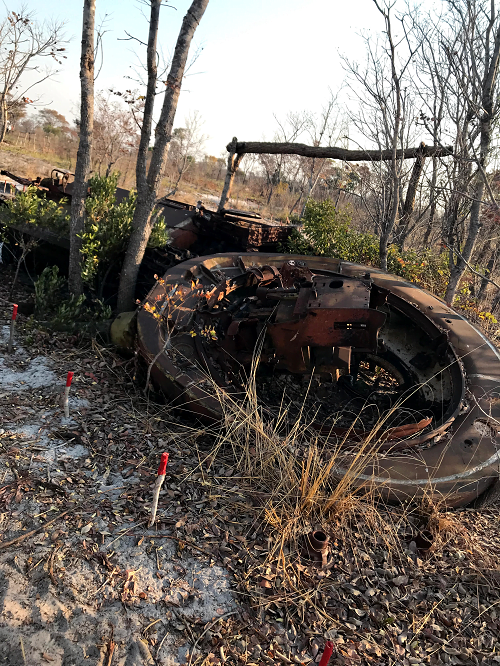
Evidence of local damage seen in Angola due to an exploded land mine.