Calling participants to take part in ground control study to assess impact in drone mapping projects
Posted on December 13, 2021 in News
Geospatial specialists at the University of Newcastle, UK are inviting practitioners and researchers to participate in an independent study to process data collected from drone LiDAR and photogrammetry surveys: the aim is to establish the impact of different control configurations on data quality. If you would like to take part you can register your interest here.
More about the ground control study
By processing the datasets and sharing your findings with the research team you will enable this important study to qualify how accurate Unmanned Aerial Vehicle (UAV) surveys can be with and without ground control and local GNSS base station information.
Raw data for this EuroSDR Commission Benchmark project will be progressively released in three phases over the course of a six-month period. Phase 1 information is available for download now. Phases 2 and 3 data will be released in 2022.
Participants will download and process the data using the post processing software they normally use when working with LiDAR or photogrammetric data. This can be standard commercial off-the-shelf processing software or an innovative research pipeline. The University of Newcastle researchers are interested in all results generated.
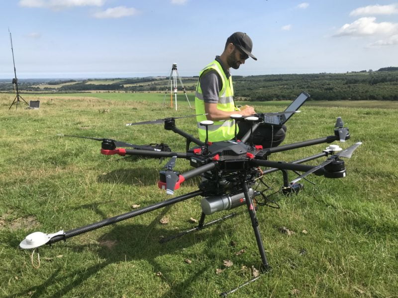
Routescene team collecting UAV LiDAR data
The team will evaluate and collate all submitted results providing independent assessment against ground truth. Results will feed into a 2022 EuroSDR workshop, paper, and inform future stages of Remote Piloted Aircraft System (RPAS) EuroSDR studies. At the end of the study, all data utilised, including ground truth, will be made open access.
How the test data was collected
The test data was independently collected in August 2021 by Routescene and DJI Heliguy. The study site was a 350 x 250m area of the disused Wards Hill Quarry near Morpeth, Northumbria, UK. The site was surveyed using a variety of technologies – the Routescene’s UAV LiDAR System and our Ground Control Targets which are specifically developed for drone LiDAR surveys; the Riegl MiniVUX; DJI L1, and photogrammetry using the DJI Phantom 4 and DJI P1.
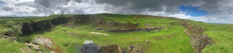
Test site at Wards Hill Quarry near Morpeth, Northumberland, UK
Gert Riemersma, CTO of Routescene, commented, “I studied surveying at Newcastle University many years ago and we were honoured to be asked to support the research team with data acquisition to enable this innovative ground control study to happen. At Routescene we develop and manufacture UAV LiDAR systems and software. We strongly advocate the use of ground control and GNSS base stations to achieve the highest possible levels of accuracy. Of course, we will be curious to find out the final results of the study and we encourage all active LiDAR and photogrammetry data users to take part.”
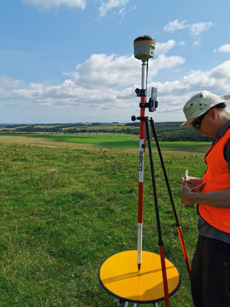
Ground control using Routescene Ground Control Targets