Routescene archaeology project at Sand Canyon featured in Geomatics World
Posted on May 30, 2019 in Media
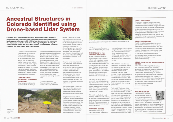
Routescene’s UAV LiDAR project at an ancient Peublo has featured in Geomatics World. In the article Routescene’s Chief Technical Officer, Gert Riemersma, explains how our UAV LiDAR survey helped the preservation team at the Crow Canyon Archaeology Center to identify new structures on the ancestral site at Sand Canyon, Colorado, USA. Drone LiDAR technology enables accurate mapping in hazardous and hostile environments. As the name implies, this site was in a steep canyon presenting difficult terrain for the survey team. Routescene’s UAV LiDAR System allowed the team to perform the survey safely and prevented them from disturbing any artefacts or structures of archeological interest.
Coverage in Geomatics World of Routescene’s archeology survey at Sand Canyon, CO, USA
Read the Geomatics World article (now GIM International)