Histogram for Routescene Ground Control Targets
Posted on March 6, 2020 in
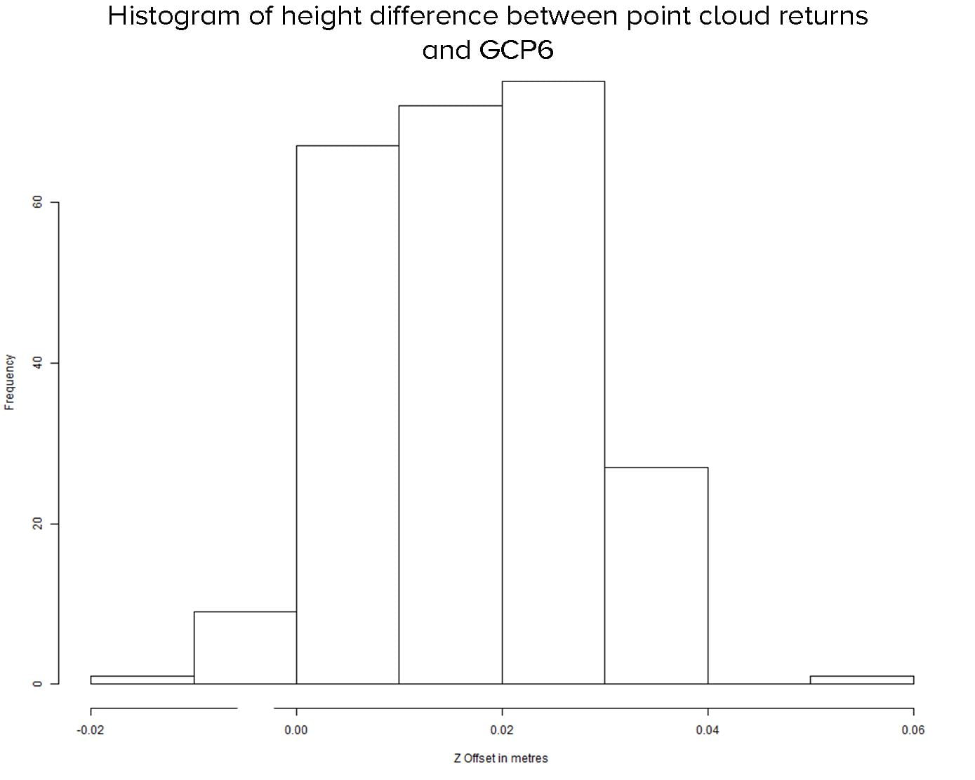
A Histogram showing the Z difference between the Ground Control Target’s known height and that derived from the LiDAR point cloud. 0.01m spacing, 250 hits.
Sand Canyon, Colorado, USA.